Artificial Reef Program News (cont'd.)
Phase II deployments are anticipated in Fall 2025!
-390x292.jfif)
Coordinates for Phase I are now available!
March 19, 2025
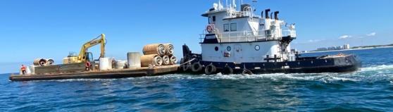
Phase I of the 2024–2025 NRDA project has been successfully completed through a partnership with the Florida Fish and Wildlife Conservation Commission. Bay County deployed thirty massive Super Reefs in federal waters within the LAARS B permitted area, creating valuable marine habitats.
These reefs were installed over three winter trips by Walter Marine, with each concrete structure weighing approximately eighteen tons. Most reefs stand fifteen feet tall, and some feature ten-foot vertical extension poles, reaching a total height of twenty-five feet to attract pelagic species like amberjack.
Every Super Reef is designed with layered EcoDiscs that provide shelter for juvenile fish and baitfish, supporting a thriving ecosystem. The reefs are located southwest of St. Andrew Bay Pass, ranging from 17 to 32.5 nautical miles offshore, and aligned along the same longitude for easier navigation.
Phase II coming soon!!
June 11, 2024
Phase I of the RESTORE project was also completed in spring 2024, adding eight new patch reef sites in the SAARS M permitted area. These artificial reefs are positioned about six nautical miles southwest of St. Andrew Bay Pass, offering plenty of great fishing spots just in time for the fall season.
April 30, 2024
The G.D. Blomberg Memorial Reef is a 65-foot aluminum patrol boat that honors the father of Hans Blomberg, who served as Technical Manager for hopper dredging at Weeks Marine and oversaw coastal restoration projects across the United States.
This memorial vessel now rests at a depth of 130 feet within the federally permitted LAARS B area, making it a meaningful addition to Bay County’s growing network of artificial reefs that support marine life and recreational opportunities.
The retired 65-foot Swiftships patrol boat is the newest vessel to become an artificial reef in Bay County waters. It was deployed in the LAARS B permitted area, where it will provide habitat for fish and attract divers and anglers seeking exciting new spots offshore:
- Latitude: 29° 40.797’ N
- Longitude: 85° 57.769’ W
October 24, 2024
Eastern Shipbuilding has officially announced the start of the second annual Coastline Initiative, continuing its commitment to education and marine conservation. Students enrolled in welding programs across Bay and Gulf Counties are leading the way in innovation while contributing to projects that enhance marine habitats.
This initiative provides hands-on experience for students, allowing them to apply technical skills to real-world projects that benefit local ecosystems and coastal communities. By combining education with environmental stewardship, the Coastline Initiative helps prepare the next generation for successful careers while improving marine life sustainability.
Read the Professional Mariner article here:
Eastern Shipbuilding helping students create artificial reefs
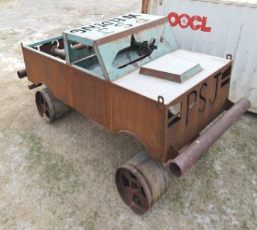
April 18, 2023
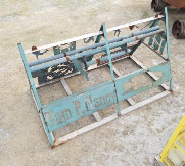
Wakulla High School, Wewahitchka (Wewa) High School, Port St. Joe (PSJ) High School, Haney Technical College, and Chipola College submitted designs for artificial reef construction. PSJ and Wewa submitted a combined project and in Spring 2023, four reefs were deployed in Bay County's LAARS B permitted area. The reefs are now flourishing!
*BCARA is a 501(c)(3) non-profit independent of Bay County's Artificial Reef Program.
Bay County Artificial Reef Program Goals
We strive to improve experiences for all marine user groups by creating safe, sustainable, and productive reef environments. The Bay County Artificial Reef Management Plan serves as a guide for implementing a successful artificial reef program in our local waters.
This plan follows the goals and objectives established by both the National and State Artificial Reef Plans, ensuring consistency with best practices and environmental standards. These objectives focus on enhancing marine habitats, supporting recreational fishing and diving, and promoting long-term ecological health for coastal communities. Goals:
- Ensure all reef construction has biological justification to meet present and future fisheries management and resource protection needs.
- Minimize conflicts and negative effects on existing fisheries.
- Use materials that are proven to have long-term compatibility with the marine environment.
- Monitor reefs to help determine efficacy of materials, reef success, and compliance with permitting terms and conditions.
- Incorporate monitoring and scientific research findings into future reef construction to produce targeted results.
Thank you for visiting!
Updates for all deployments can be found on our Facebook page:
UF IFAS Extension Bay County | Panama City FL | Facebook
.gif)
 Bay County Artificial Reefs
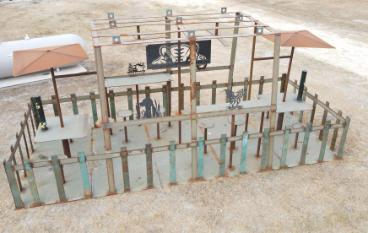

-721x402.jfif)
-721x402.jfif)