How Do I... Explore with Story Maps?
A story map is a tool that combines information, maps, images, videos, and more into an interactive application to explore and learn. The story maps below were designed to connect residents and visitors with the many outdoor- and nature-related experiences available at county locations and to share information on the county’s water quality initiatives. The maps allow users—including individuals who otherwise might have difficulty visiting these spaces—to experience and connect with natural areas of the county, and to dive more deeply into information available about those spaces and efforts to protect them.
Developed as a collaboration between multiple Sarasota County departments and offices—Extension and Sustainability; Parks, Recreation and Natural Resources; Libraries and Historical Resources; and Enterprise Information Technology—the virtual tools increase accessibility and provide opportunities to explore and learn from wherever you are. They also provide users a richer experience when visiting areas in person, by making available online a deeper well of information about sites, noting unique or interesting features to visit, and more.
Click on a header, map image or link in the map descriptions (below) to open the story map and being exploring.
Community and Demonstration Gardens
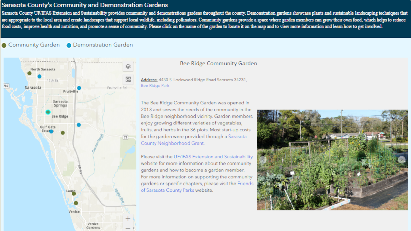
The gardens story map highlights the locations of various gardens, shares links to venue information, and provides history of the gardens and photos of resources at each site. The tool helps showcase how gardens serve as community connection spaces and areas to grow fresh food, support sustainable landscaping and native wildlife, and much more.
Green Business Partnership
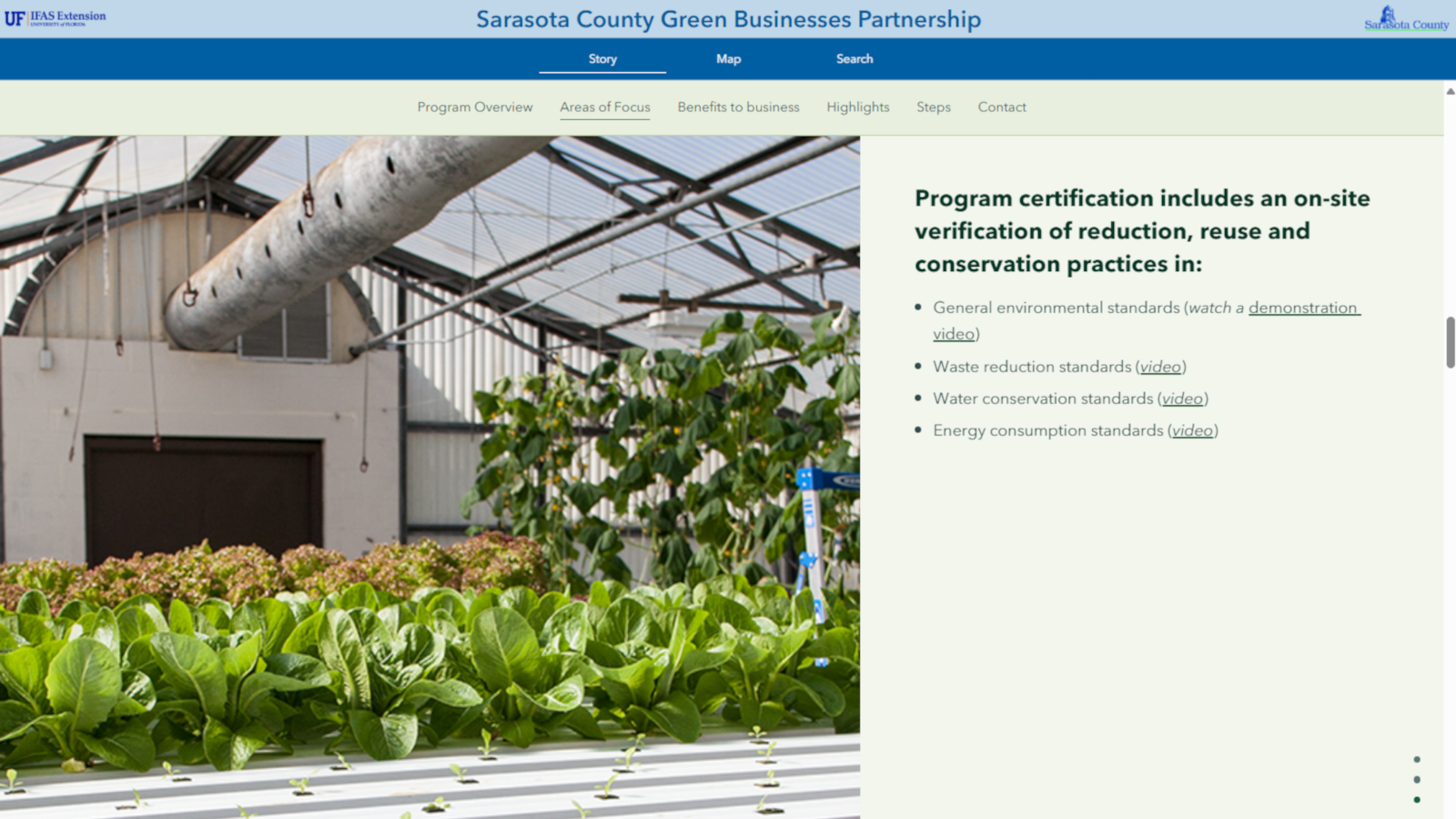
The Green Business Partnership story map provides an interactive look at how businesses can adopt practices that promote sustainability and benefit the overall community while cutting costs. Featuring short explanations of program areas and steps to get involved, this interactive tool also includes a map pinpointing all partners across Sarasota County and highlights partners that have seen substantial benefits.
Heat Vulnerability
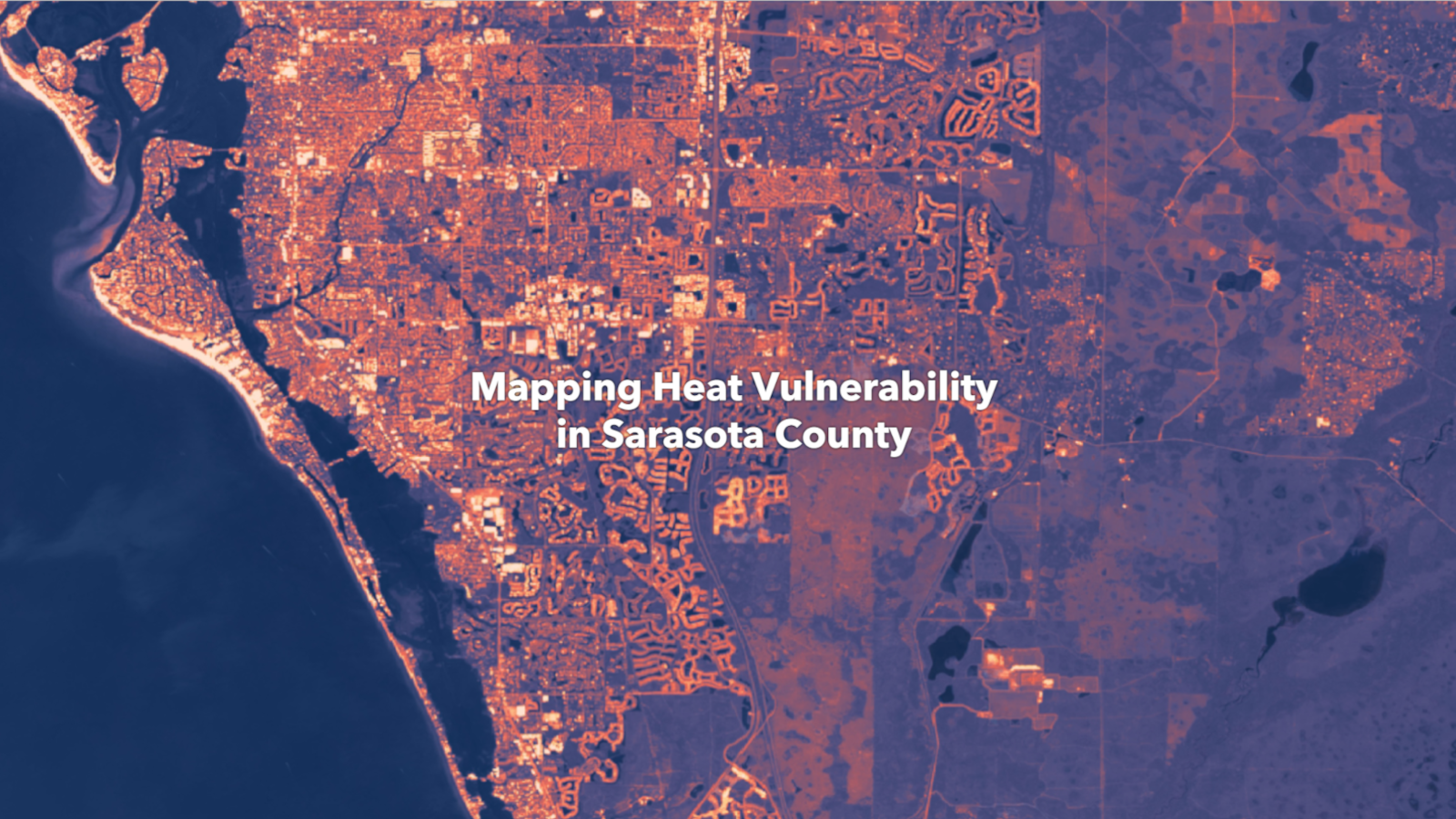
The Mapping Heat Vulnerability in Sarasota County" story map explores the growing risks of extreme heat across our community. Interactive maps and data highlight the three most heat-vulnerable “hotspots” in the county and most-impacted neighborhoods. This interactive tool also offers practical tips for staying safe in extreme heat and techniques for keeping homes cool, and helps communities take steps to stay safe, cool, and resilient.
Natural Areas
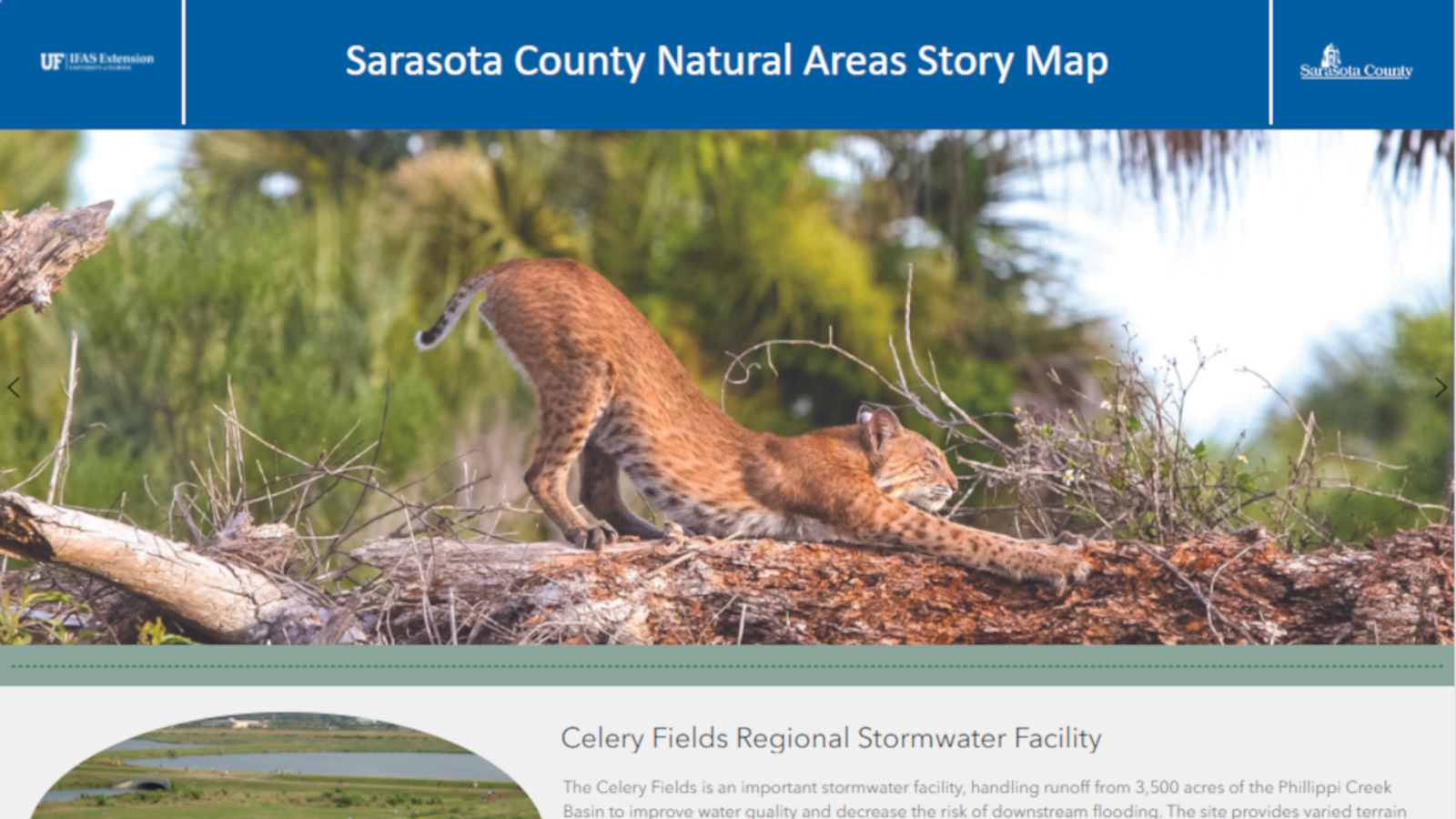
With the natural areas map, users can take a virtual, guided hike along a trail in some of the unique and precious natural areas in Sarasota County to learn more about the plants, animals, and habitats found at each site, view photos taken along the trail, and find additional information and resources about Sarasota County’s natural areas. Users also can use the app while visiting sites to enrich the in-person experience.
Path to Resilience
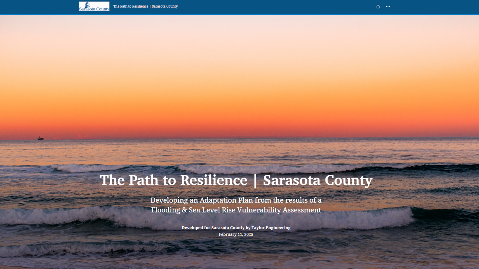
The Path to Resilience story map showcases Sarasota County's approach to assessing and addressing flood risks and sea level rise. It features interactive visuals highlighting vulnerable areas, critical infrastructure, emergency facilities, and adaptation strategies. This tool provides insight into local challenges and ongoing efforts to build a more resilient and sustainable future.
Water Quality
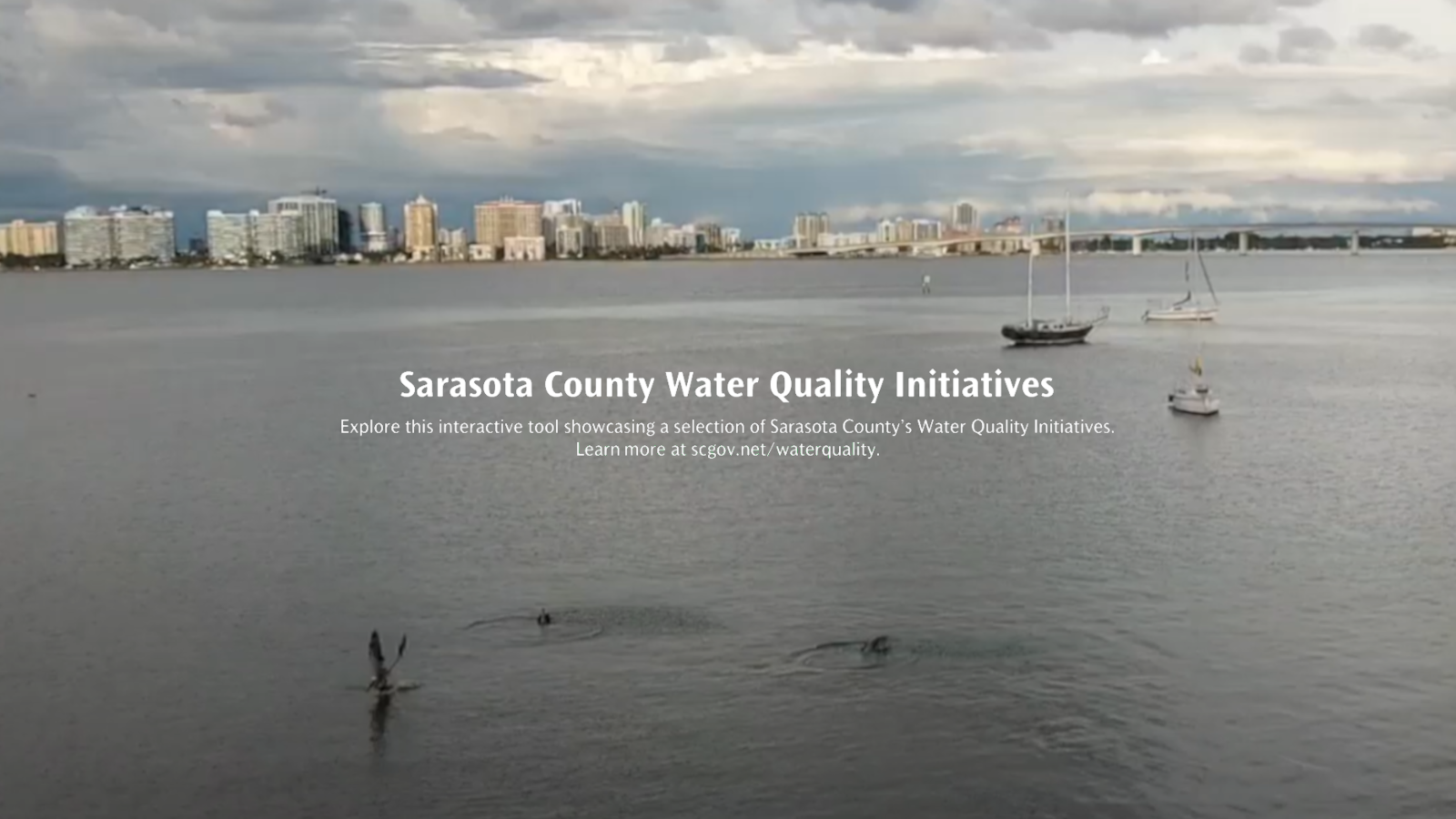
Sarasota County has implemented many programs and initiatives to protect water quality through infrastructure improvements, conservation, restoration and education. The water quality story map highlights a selection of those initiatives to provide an interactive introduction to the diversity of water quality protection efforts and share ways for residents to get involved.
Learn more about...
- Community and Demonstration Gardens
- Green Business Partnership
- Horticulture
- Parks, Preserves and Other Natural Areas
- Natural Resources
- Sustainability and Resiliency
- Water Resources
- Water Quality
More story map resources...
- Sarasota County’s Natural Areas Story Map Brings Nature to You
- Sarasota County Launches Interactive Water Quality “Story Map”
- Videos:
- Blogs: blogs.ifas.ufl.edu/sarasotaco/tag/story-map/
Explore other story maps and interactive maps...
- Sarasota County GIS
- Sarasota Bay Watershed (Sarasota County Public Works)
- Sarasota County Water Atlas (University of South Florida)
Learn More
- About Us
- Blog posts
- Events, Camps, Clubs, Training and More
- Key Documents
- News, Notes and More
- Speakers Bureau
- Staff Directory
- Story Maps
- Timeline of Extension
- Videos
- Volunteers
- How Do I...
- ...Learn What Extension Offers?
- ...Find Career Training and Development?
- ...Find Events, Camps, Clubs, Training and More?
- ...Find Key Extension Documents?
- ...Find Youth and Family Opportunities?
- ...Get Soil/Irrigation Water Tested?
- ...Request a Speaker?
- ...Learn Best Practices for My Neighborhood?
- ...Explore with Story Maps?
- ...Use the Sarasota County Starter Kit?
- ...Tour Extension Virtually?
- ...Donate to Extension?